
This Article From Issue
January-February 2005
Volume 93, Number 1
DOI: 10.1511/2005.51.0
Making Mice: Standardizing Animals for American Biomedical Research, 1900–1955. Karen A. Rader. xx + 299 pp. Princeton University Press, 2004. $45.
By the mid-20th century, mice had become arguably the most ubiquitous vertebrate experimental organism in biomedical research. In Making Mice, Karen Rader explores how they came to have this status, not only in institutional and scientific terms but also within a much broader sociocultural context.
Rader's provocative history, which draws on a broad range of source materials, from scientists' correspondence to imagery from popular culture, focuses primarily on "JAX mice," so named for the Roscoe B. Jackson Memorial Laboratory in Bar Harbor, Maine, where they were bred, or rather, inbred. Rader examines the perspectives of various groups who have used these mice—not just those who have done research with them at the Jackson Lab itself or have purchased them for studies elsewhere, but also those who have used them as "cultural icons"—U.S. policy makers, for example, who in the mid-20th century promoted their use in biomedical research, and in particular in the war on cancer. The book makes an important contribution to the growing literature on the history of biology and experimental organisms, with the interplay between science and society as a backdrop. The reader comes to understand both the scientific uses of the JAX mice and their role in transforming biomedical research into "big science" in the 20th century.
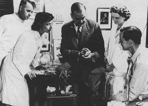
From Making Mice.
Ad Right
Some of the major changes in the biomedical research agenda over the course of the first half of the 20th century can be traced through the use of these mice, first for cancer research and later for investigation of radiation damage. Rader does not focus on any one line of research. Instead she develops an argument that not only did inbred mice become "standardized" in the usual scientific sense, they also came to be a crucial biomedical resource by serving as a "standard"—as an iconic, conspicuous object that could be used as a rallying point.
The development of standardized mice strains helped to resolve two tensions in the domain of biomedical research. First, there were ongoing debates about the potential artifactuality of manufactured systems and technologies such as inbred mice as compared with "natural" experimental systems, such as non-inbred mice or organisms from the wild. Thus to use inbred mice was to make not simply an experimental choice but an epistemological one, and their popularity in turn shaped political and social negotiations about funding for biomedical research, particularly for cancer. The study of human diseases using standardized animal models has now become routine practice, but its acceptability was established in large part through the use of inbred mice, as Rader convincingly argues.
The second tension that Rader outlines (but unfortunately does not explore in much detail) is the issue of the acceptance in American culture of the use of animals as research subjects. Clearly mice were not as socially valued as dogs, for instance, and the rise and dominance of mice as experimental organisms thus can be seen not only as a matter of scientific preference but as a culturally embedded choice. Objections to the use of mice as subjects were even more unlikely when it could be argued that pursuit of the research was essential for human health.
The narrative is roughly chronological, focusing first on Clarence Cook Little, the founder of the Jackson Laboratory. Little had studied genetics at Harvard's Bussey Institute in the 1910s and as part of his studies on inheritance of coat color had produced the first inbred strain of mice. His vision for the Jackson Lab clearly originated in his own research, and in particular in the idea that pure-line mice were essential for doing experimental genetics. In his early career, he was best known for an ongoing feud with fellow cancer geneticist Maud Slye, who claimed (based on studies with mice that were not inbred) that cancer was inherited in a simple, recessive manner. This debate was covered even in popular magazines, and Rader uses innovative source materials to make it clear that Little was a public figure from early on, a fact that helped to lay the groundwork for his academic career as an administrator and research scientist.
In 1929, Little left his post as president of the University of Michigan (where he had made some small-scale attempts to establish institutes focused on research with inbred mice) and founded the Jackson Lab with funding from a variety of philanthropies. The timing proved crucial: Financial difficulties precipitated by the stock market crash and the onset of the Great Depression forced Little to consider other means of support for research at the lab. The sale of mouse strains to other researchers was not an obvious solution (in part because of the tradition within biology of freely sharing research resources), but eventually this became the primary source of income for the lab.
In subsequent years, Little struggled to maintain active research programs while simultaneously building the infrastructure for raising great numbers of mice at the lab. He frequently faced criticism that the enterprise was merely a commercial one, and he was even confronted with a lawsuit claiming that the lab should lose its nonprofit status and be forced to pay taxes on its prime piece of land.
A turning point came in 1947, when a fire swept through Bar Harbor, killing 14 people and tens of thousands of mice. In the aftermath of this disaster, there was an unprecedented infusion of resources to rebuild the lab, and the public and the research community supported reestablishment of the mouse colonies, confirming the importance of the lab both as a scientific institution and as a sociocultural one. Numerous laboratories had come to depend on the Jackson Lab not only for the supply of experimental strains but also as a critical contact point between research groups, facilitating the shared standards necessary for productive experimentation.
Later chapters are intriguing but do not follow as closely as the reader might hope from the early part of the narrative. Rader provides only tantalizing hints at the next installment in the "mouse story." She examines the use of mice in studies of radiation risk, and in an epilogue she looks toward present-day uses of mice as experimental organisms.
Nonetheless, most of the book is extremely well written and enjoyable to read—unusually so for a scholarly book. Good use is made throughout of images, although there are a number of unfortunate errors in the picture captions, such as reversed identification labels in several group photographs. This is not just a history of inbred mice; rather, as the title implies, it is an account of the "making" of mice far outside the boundaries of the laboratory.—Rachel A. Ankeny, History and Philosophy of Science, University of Sydney, Australia
American Scientist Comments and Discussion
To discuss our articles or comment on them, please share them and tag American Scientist on social media platforms. Here are links to our profiles on Twitter, Facebook, and LinkedIn.
If we re-share your post, we will moderate comments/discussion following our comments policy.