
This Article From Issue
March-April 2018
Volume 106, Number 2
Page 122
THE RED ATLAS: How the Soviet Union Secretly Mapped the World. John Davies and Alexander J. Kent. xiv + 234 pp. University of Chicago Press, 2017. $35.
Ever heard of the Topographic Directorate of the General Staff of the Soviet Army? No? That’s just how they liked it. Meanwhile, its staff meticulously mapped the world, right down to the load-bearing capacity of bridges and the girth, height, and separation of forest trees.
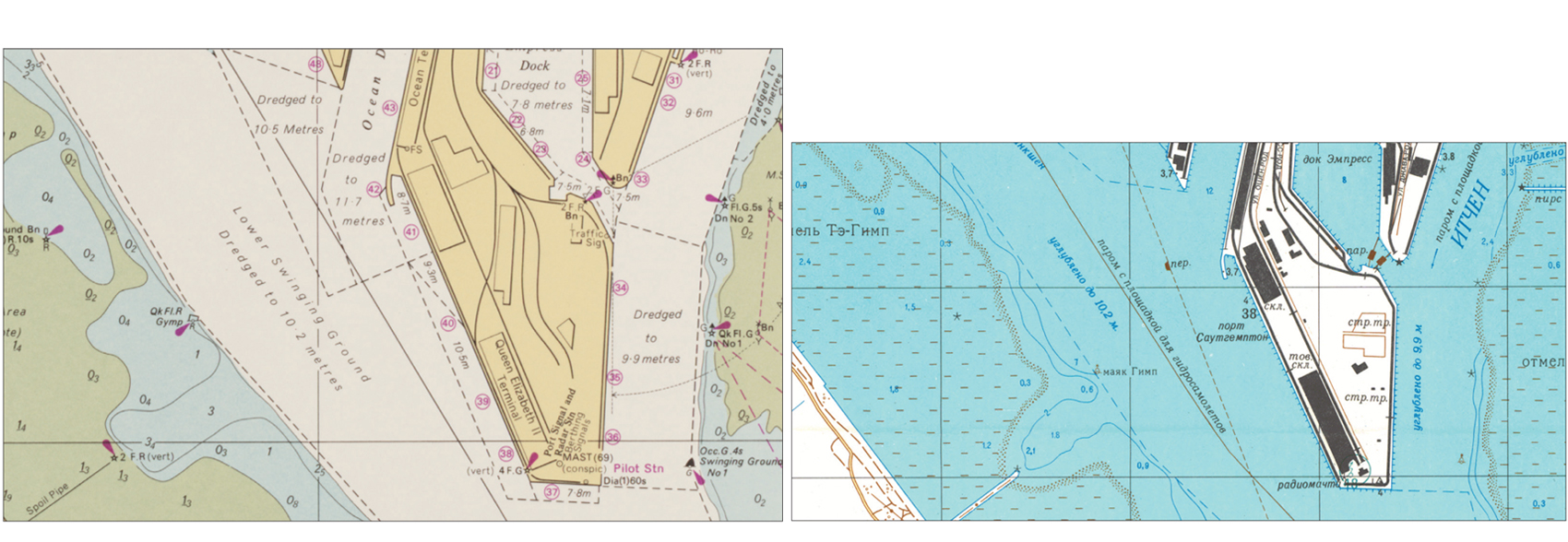
From The Red Atlas.
Soviet military map makers were prolific as well as thorough. Cartographers John Davies and Alexander J. Kent estimate that these workers may have produced a million different maps, adding that “wherever you are on the planet reading this . . . the place [was] likely. . . mapped in detail by the Soviet Union. At least once.” The project got going under Stalin, and it continued until the fall of the USSR. The maps were secret, many of them highly classified, and kept under tight control. Cold War diplomats and spies relied on them, and the army kept the vast store of maps on hand for potential use in invasion and occupation plans.
Created using data from sources such as satellites, reference works, and spies, the Soviet maps were often more accurate than other nations’ maps of their own territory—or any other maps, for that matter. During the 2001 invasion of Afghanistan, American pilots used 1980s Soviet maps of the region.
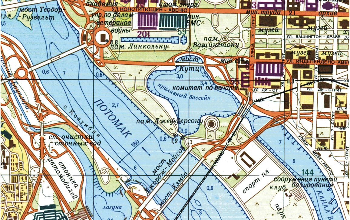
From The Red Atlas.
Because the cartographers were working with incomplete and occasionally outdated or otherwise inaccurate data, the maps aren’t always completely accurate. A 1970s-era depiction of the District of Columbia, for example, still included temporary facilities used during World Wars I and II that had been destroyed a few years before the map was compiled.
Regardless, these masterpieces of cartographic art and science are unfailingly stunning. In the 1970s, their makers began using 10-color printing, which requires painstaking accuracy but allows for more granular color coding. Likewise, The Red Atlas is gorgeously designed. The maps have been lovingly reproduced, and great care has gone into the details of the book’s design—from the patriotic crimson endpapers to the back cover’s trompe l’oeil envelope closure, with its added note of Cold War spycraft whimsy.
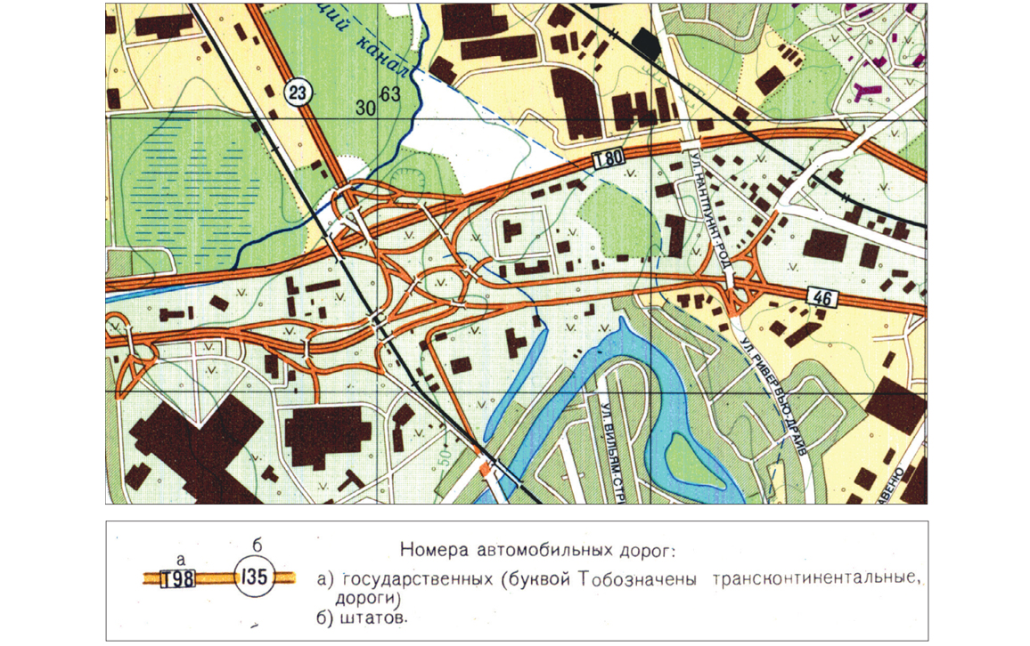
From The Red Atlas.
A version of this review appears online alongside capsule reviews of 11 other STEM titles. See “New Readings for a New Year, 2018.”
Dianne Timblin is book review editor for American Scientist.
American Scientist Comments and Discussion
To discuss our articles or comment on them, please share them and tag American Scientist on social media platforms. Here are links to our profiles on Twitter, Facebook, and LinkedIn.
If we re-share your post, we will moderate comments/discussion following our comments policy.